- ACA Rating: 3B IV
- Distance: ~10 miles
- Elevation range: 8160′ to 4000′
Tenaya Canyon is becoming a yearly event. For Tim and I, it is our 3rd time down this rarely visited part of Yosemite National Park; for Ken, it is his second trip. Though not a walk in the park, it is a fun and exciting adventure, especially when it turns into a 17 hour marathon hike.
The route starts at Tenaya Lake in Yosemite Valley. It involves walking on steep granite slabs, bushwhacking through thick forest, hiking across talus fields, rappelling alongside waterfalls into frigid pools of water, scrambling over car-size boulders, and strolling over a dry rocky creek bed. Does it still sound like fun?
We start at the Sunrise Lakes Trailhead and follow the trail for about a mile before veering off-trail along Tenaya Creek. Along the way, we catch up with two hikers visiting Tenaya Canyon for the first time, Tony and Ian. Our group of 3 becomes a group of 5. This section is a moderate walk in the park until we reach the first landmark, a sign warning visitors of the danger ahead.


After the sign, we scramble over granite slabs and boulders and reach the next landmark, a colossal granite bowl carved by glaciers some years ago. We descend the bowl following the creek and enter a small section of forest which requires some bushwhacking and scrambling over fallen trees. The aspens interspersed with the pines add a touch of color to the landscape.
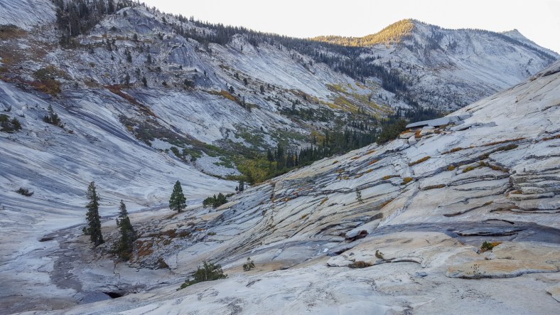
Granite bowl


Once past the forest, we ascend towards the Lone Boulder. This is a critical landmark not be missed, lest one up taking the quick way down Pywiack Cascade. The iconic Half Dome is visible in the distance, as well as Glacier Point and Yosemite Valley. Looking back the way we came, we can see Tenaya Peak.
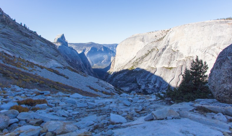
At the Lone Boulder

Tenaya Peak in the distance
To reach the next landmark, a creek running down the east wall of the canyon, we have to bushwhack through willow and groves of aspen trees, and then scramble across talus fields. From there, we’ll descend 1300′ feet on a steep granite slope to the bottom of the canyon. Some will find this section to be nerve wracking because the bottom of the canyon remains in view at every step, a constant reminder of the consequences if one were to slip and fall.


")

Once at the creek, we pass through the Lost Valley, a charming paradise whose beauty is augmented by the fall colors of the flora. I frequently encounter shrubs full of red pea-size berries, and always wonder why they remain untouched. I have now learned that these particular ones are red elderberries, which can be poisonous to humans. If eaten in large quantities, they can cause a buildup of cyanide in the body. I imagine they might be toxic to other animals as well.

")


After the Lost Valley, we reach the first anchor, a 70′ rappel from a ledge to the bottom of the creek.
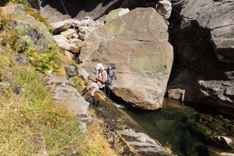
Tony on the first rappel
We quickly move on to the Inner Gorge and the second anchor, an exciting rappel alongside a torrent of water and into a frigid pool. Luckily, the sun is still overhead and the air temperature is in the high 60s.


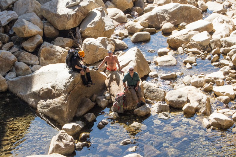
Tim, Tony, and Ian enjoying the sun’s warmth after rappelling and swimming in the frigid water
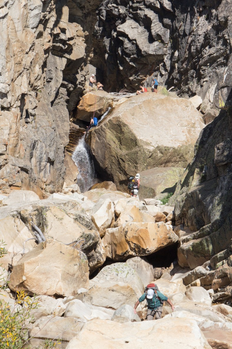
The 2nd rappel
After basking in the sun for a bit, we move on to the 3rd and 4th anchors. By the time we are done with the 4th rappel, the sun is beginning to set. Sections of the canyon are completely in the shade as we exit the gorge, and we still have 4 miles to go.


Eventually, we lose sunlight and we end up hiking through the night on a creek bed filled with rocks of varying sizes: from sand to pebbles to cobbles to boulders. As soon as car-size boulders start popping up, we leave the creek and head for the hillside. I can’t really see the trees, but the scent of the bay leaves is strong.
Fifteen hours after leaving my car at Tenaya Lake, we reach Tim’s car. Not too bad, last year it took us 17 hours. Perhaps next year we’ll make it to the valley floor quicker, and we’ll celebrate with a pizza at Curry Village.


