- Distance: 16 miles
- Elevation range: 8500′ to 10,500′
- Route: Caltopo, P1
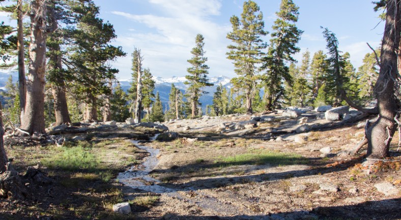
I started from the Cathedral Lakes TH off Tioga Road (Hwy 120). About 1/2 mile in, I left the maintained trail and continued on the climber’s trail which runs along Budd Creek and ends at Cathedral Peak. There is a saddle south of the peak, from which one can enjoy 360° views of the Yosemite high country. I am not particularly fond of hiking through forested sections of trail, so upon reaching this saddle, I was ecstatic.


From this point forward, travel would be cross-country. The risk of becoming lost around here is minimal. The terrain consists of expansive granite slopes, bowls, and ever-present peaks which can be used to navigate.
I crossed fields of snow and scree on my way to Echo Peaks. This group of summits are creatively named #1 through #9. Numbers 6 and 9 require technical climbing skills, but the rest have Class 3 approaches to their respective apexes. I scrambled to the top of #8, before heading below Echo Ridge towards the north end of Matthes Crest.


Matthes Crest is an impressive fin of metamorphic rock extending south from Echo Ridge. Its high-point is the north peak (10,918′). I spent the better part of an hour observing climbers as they traversed this knife-edge ridge, some roped and some free soloing. Matthes Crest is now on my to-do list for next year.


I descended 1400 feet along a stream of snowmelt, crossed Cathedral Fork, and hiked up to a knob situated between Columbia Finger and Matthes Crest. I set up camp, searched for water, ate dinner, and then relaxed and enjoyed the sunset. I woke up around 0200 to take some photos of the night sky. The moon was full and visible through most of the night.


On Sunday morning, I continued west, crossed the JMT, and hiked up towards Columbia Finger (10,360′). I took the Class 3 approach, but did not scramble onto the summit block; it looked a bit intimidating. From this vantage point, I could almost peek down into Yosemite Valley. I could also see my next destination, Tressider Peak (10,600′), to the north.


I wanted to get on the summit of Tressider Peak, but it looked fairly challenging, so I decided I would hike up to one of the windows at the north end and take a peek down into Upper Cathedral Lake. I hiked up the scree slope to the base, and confirmed the difficulty of scrambling to the summit. I only managed to reach the ridge below the summit block, where I spotted my next target, Tenaya Peak (10,280′).


On my way to Tenaya Peak, I got a good view of Half Dome (8836′). I could see people on the section of cables, like a line of ants marching over a rock.


, Mount Conness (center background)")
After descending from Tenaya Peak, I hiked down about 600′ over a snow covered slope. The first 200′ feet were sketchy. The snow was firm, but it was steeper than I estimated from the top of the chute, perhaps about 45°. It wasn’t impossible, but it did require my complete focus at every step. I didn’t want to take the fast way down and end up wrapped around a tree or a rock.
In order to reach the outlet creek from Lower Cathedral Lake, I needed to cross a field of talus. I usually find this a fun exercise, but I was a bit exhausted by now. Nonetheless, it was preferable to hiking down into the forest to more stable ground, and then climbing to Lower Cathedral Lake.


When I reached the creek, I refilled my water bottle, ate lunch, and took a break, relishing the sound of the cascading water, the fresh cool breeze, the texture of the granite, the smell of pine trees, and the chirping of birds. I also observed some fantastic wildlife.


About an hour later, I reluctantly packed my gear and made my way up the creek to Lower Cathedral Lake. I visited this lake in May of 2014 when most of the trail and the surrounding meadow were covered in snow. It was a pretty sight then, and it was a pretty sight now under the summer sun. I took another break when I reached the granite bench on the east shore of the lake. The water temperature was about 70°F, just perfect for jumping in to clean up and cool off.


Lower Cathedral Lake would be the last enjoyable sight on this trip. The remaining 3.5 miles to the car involved hiking through forest on a maintained trail. The forest has its own unique character – the fragrance of pine leaves, birds gracefully flying between the trees, chipmunks darting along tree branches, saplings sprouting next to burnt tree trunks, the sun’s rays bursting through the tree canopy – but, it is not my preferred terrain.
However, I did encounter this young buck sauntering across the trail. It paused, struck a pose, and then continued on its merry way.
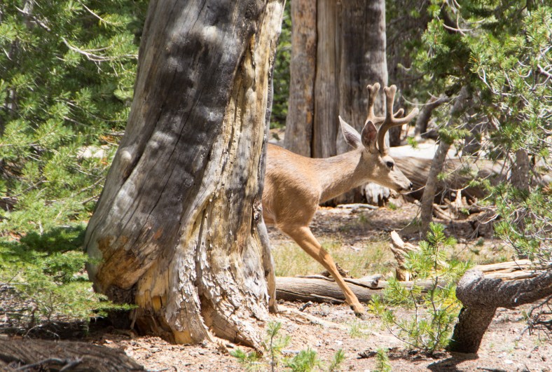
California Mule Deer (Odocoileus hemionus californicus)
